War Eagle Copper Project
Watch this project
on YouTube
Introduction
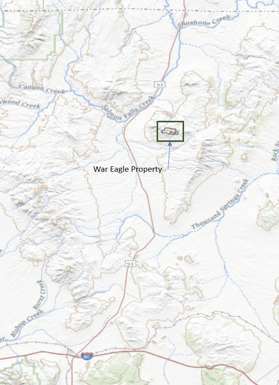
The War Eagle Copper Project is located Northern Elko
County, Nevada; about 50 miles North of Wells, NV along U.S.
Highway 93 (Figure 1).
The project is part of the Southern
end of the Contact District, which is known for historic and
more recent copper, gold, silver, and other base metal
exploration.
The War Eagle property is a set of lode claims that span 2
square miles within an Area of Interest (AOI) that is
comprised of 15 square miles in Township 44 North, Range
64 East, of the Southern Granite Range of Elko Co., NV.
Recent work by Arkenstone Exploration includes field work
that comprised geologic mapping and structural
interpretation as well as the desktop compilation of the
mapping work into a cohesive geologic map of the War Eagle
property.
Project Images
Geologic Mapping
The geologic mapping completed on site was conducted over three field days from Oct. 3rd thru 5th
,
2023. Arkenstone Exploration utilized a GPS-enabled tablet to record geologic and structural data
across much of the current claim block.
The 1
st day of mapping centered around the Arizona/Turo mine
areas as marked on original USGS topo maps.
Subsequent days focused on areas along strike of the Paleozoic – Intrusive contact in both directions
(East & West). This approach allowed for a very efficient mapping program that achieved full-coverage
of relevant geology within the claim block area.
Besides the tablet for recording point data and notes at each stop, a Brunton Geo-Transit was used to
collect strike & drip measurements of Paleozoic strata and other linear features such as Felsic Dikes and
the Paleozoic – Intrusive contact.
In the end the data was compiled within Google Earth and the geologic and structural interpretations
were made at the desktop level base on notes made in the field and observations highlighted by
available aerial imagery (Figure 2).
Geology
The geologic units of the War Eagle property are part of the Southern Contact District and are
presumably similar to the documented Paleozoic section found in the North and West Contact District.
At this time Arkenstone is unable to make a 1:1 comparison of those units to the units found between
Hank’s Peak along strike towards Blanchard Mountain. Much of the geologic mapping focused on the
Paleozoic sedimentary units due to their reactivity and structural importance to copper mineralization.
The intrusive granodiorite pluton could potentially host small deposits along its fringes, but this is less
likely than larger skarn or replacement style mineralization within the Paleozoic carbonate host units.
Further work might focus more on potential pegmatites or felsic dikes that cross-cut both the
granodiorite as well as the Paleozoics, but that was not the focus of this initial reconnaissance mapping.
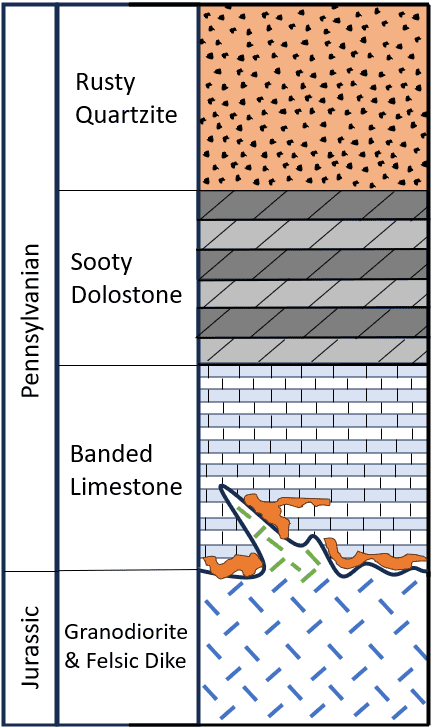
However, the mapping was successful in identifying three repeatable units in sequence. These
sedimentary units are as follows, from the bottom of the local stratigraphic section to the top:
- A) Banded Limestone
- B) Sooty Dolostone
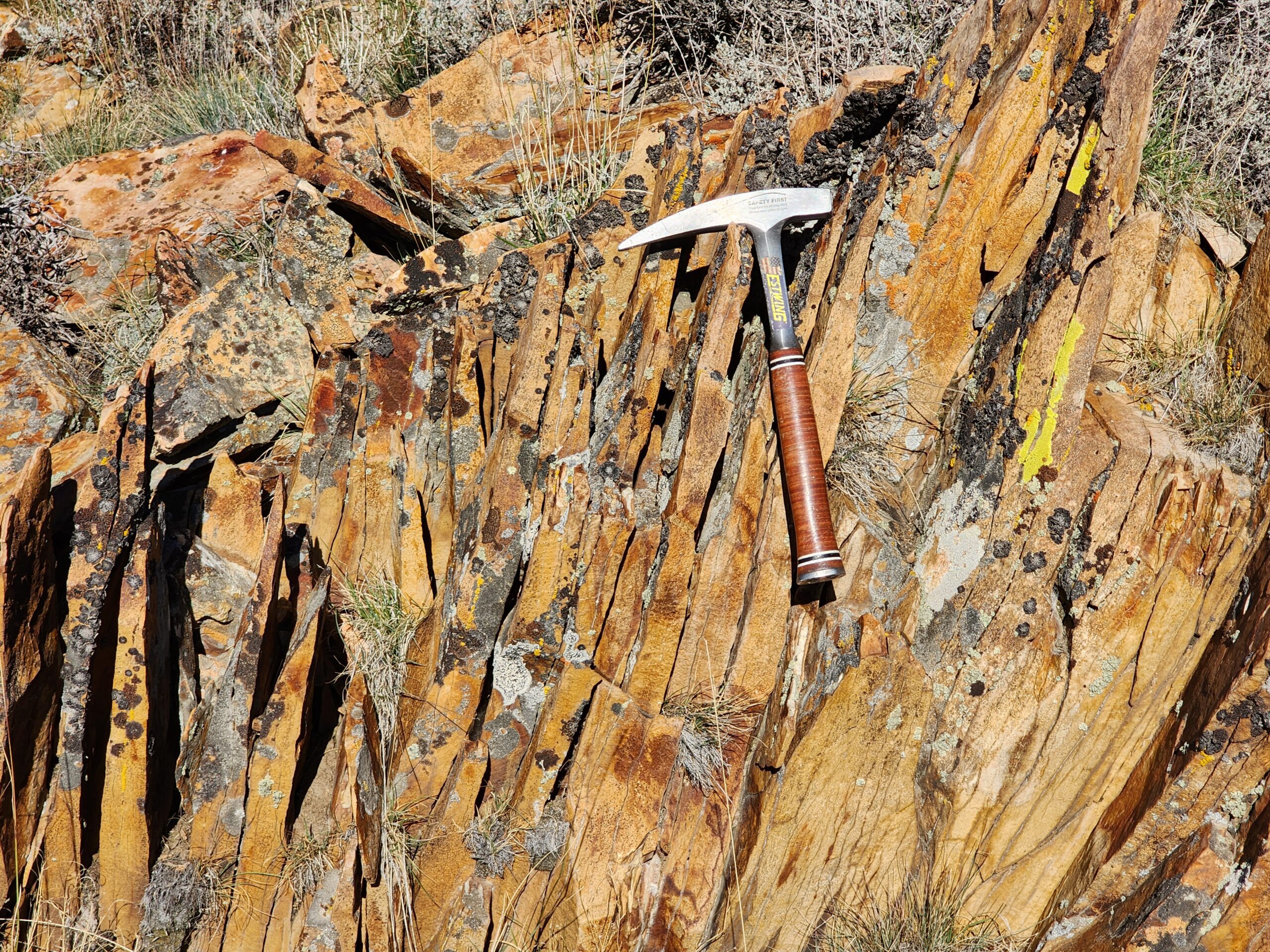
- C) Rusty Quartzite
This sequence was observed in sequence
across the entire project area and the author is confident that these strata (Figure 3) will be observed elsewhere along strike. It should be noted as well that copper mineralization has only been observed
within the Banded Limestone unit that is in direct contact with the granodiorite or adjacent to felsic
dikes.
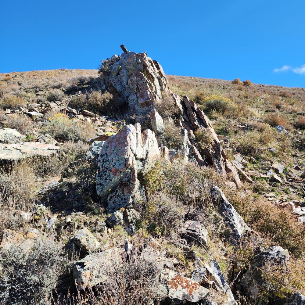
The structural setting on site is quite complex with nearly all sedimentary units near the Paleozoic –
Intrusive contact oriented at high angles or overturned. One area (highlighted on Figure 2) is an
interpreted Thrust Fault area that sits adjacent to a North-East trending fault. The south peak of Hanks
Peak was observed as a thrust sheet of Rusty Quartzite with at least two further duplexed thrust folds
paralleling this stacked structural system.
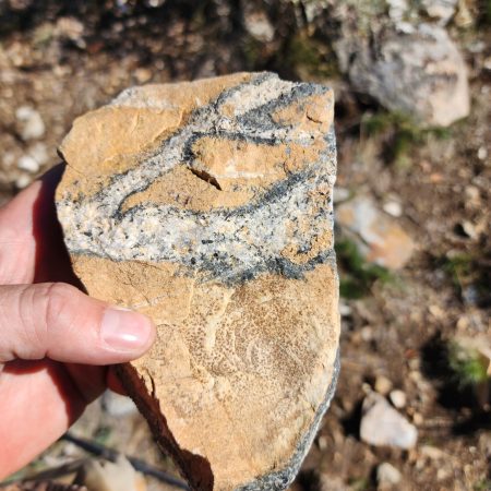
Granodiorite
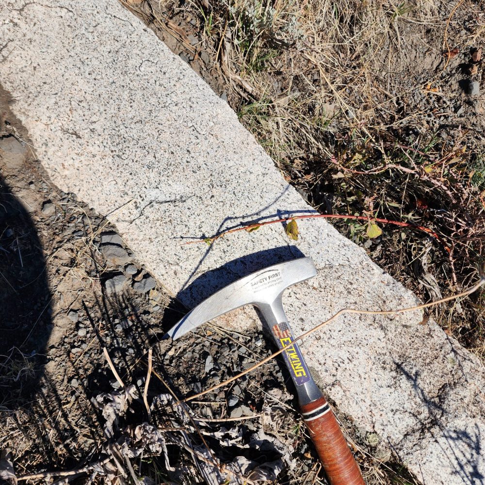
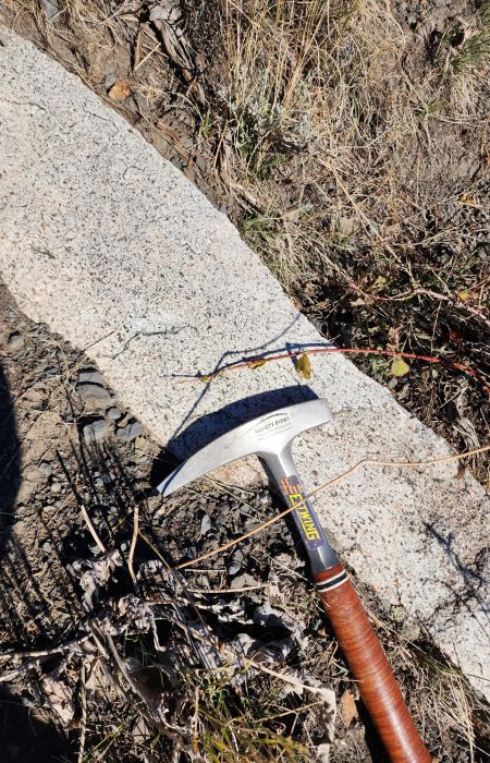
The Contact district’s granodiorite stock is comprised of a medium to coarse grained rock that contains
quartz and is distinguished from granite by having more plagioclase than orthoclase feldspar; other
minerals include hornblende, biotite, and augite. Along the Paleozoic – Intrusive contact North and
West of the Arizona Mine area there was observed a pegmatitic texture to the granodiorite with an
interpreted felsic dike cross-cutting both the intrusive and Paleozoic units at an ENE trend. This feature
was mapped and can be found on the accompanying geologic map (Figure 2).
Besides the granodiorite serving as an obvious heat source for mineralization, it would also seem that
this relationship between cross-cutting features such as the pegmatitic felsic dike and coeval structures
that carry into the Paleozoic sediments could be a pathway for enhanced mineralization and evidence of
multiple episodes or pulses of ore-bearing fluids into the carbonate host rocks.
Banded Limestone
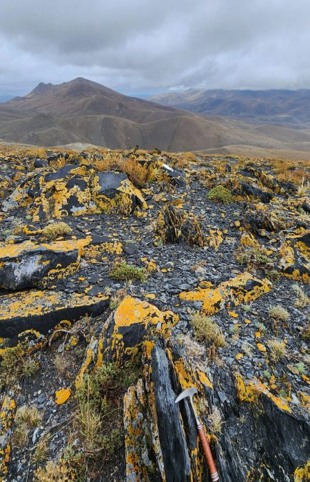
The Banded Limestone unit is quite distinguishable from all other units found in the War Eagle project
area. All of the readily observable copper mineralization, especially that mineralization found around
the historic diggings (Babel, Arizona/Turo, & Rosie O’Connell/War Eagle areas), are all found within this
unit that lies in direct contact with the granodiorite stock.
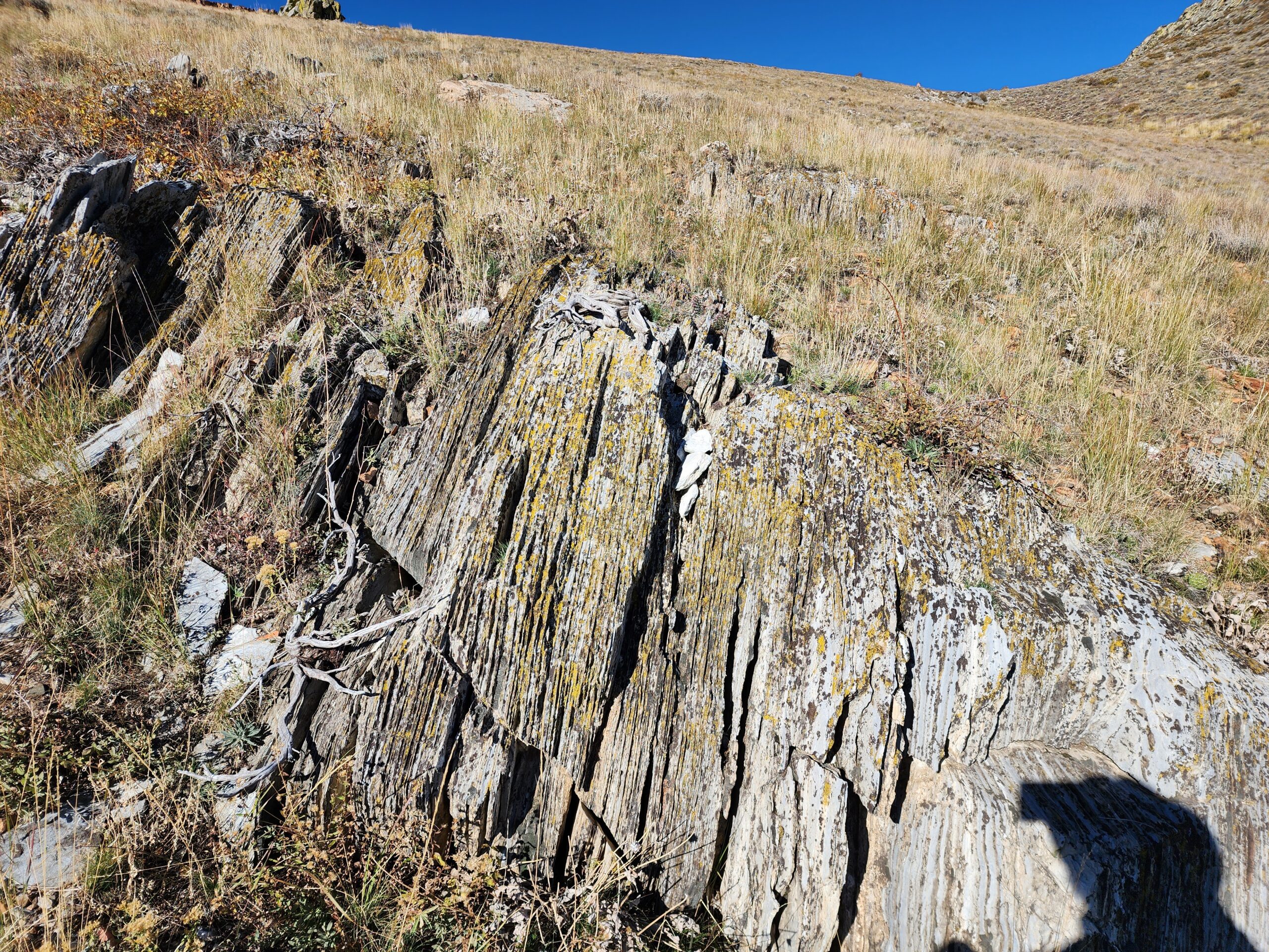
The Banded Limestone unit is a thinly laminated, fine-grained limestone. The unit has some observable
cherty bands locally, while those same cherty bands are absent within other locations or horizons and
therefore could simply be an alteration feature. The unit as a whole has a bluish-white to light gray
color that is easily identified from a distance as well as from aerial imagery.
Along strike this same unit is presumably the dominant unit that comprises “White Peaks” on China
Mountain to the West of the War Eagle project. This area was not mapped by the author, however,
during the traverse up to Hank’s Peak (which is on the North-Western most reaches of the current claim
block) the distinct Banded Limestone unit is easily traced across the mountain range from one peak to
the next.
Sooty Dolostone
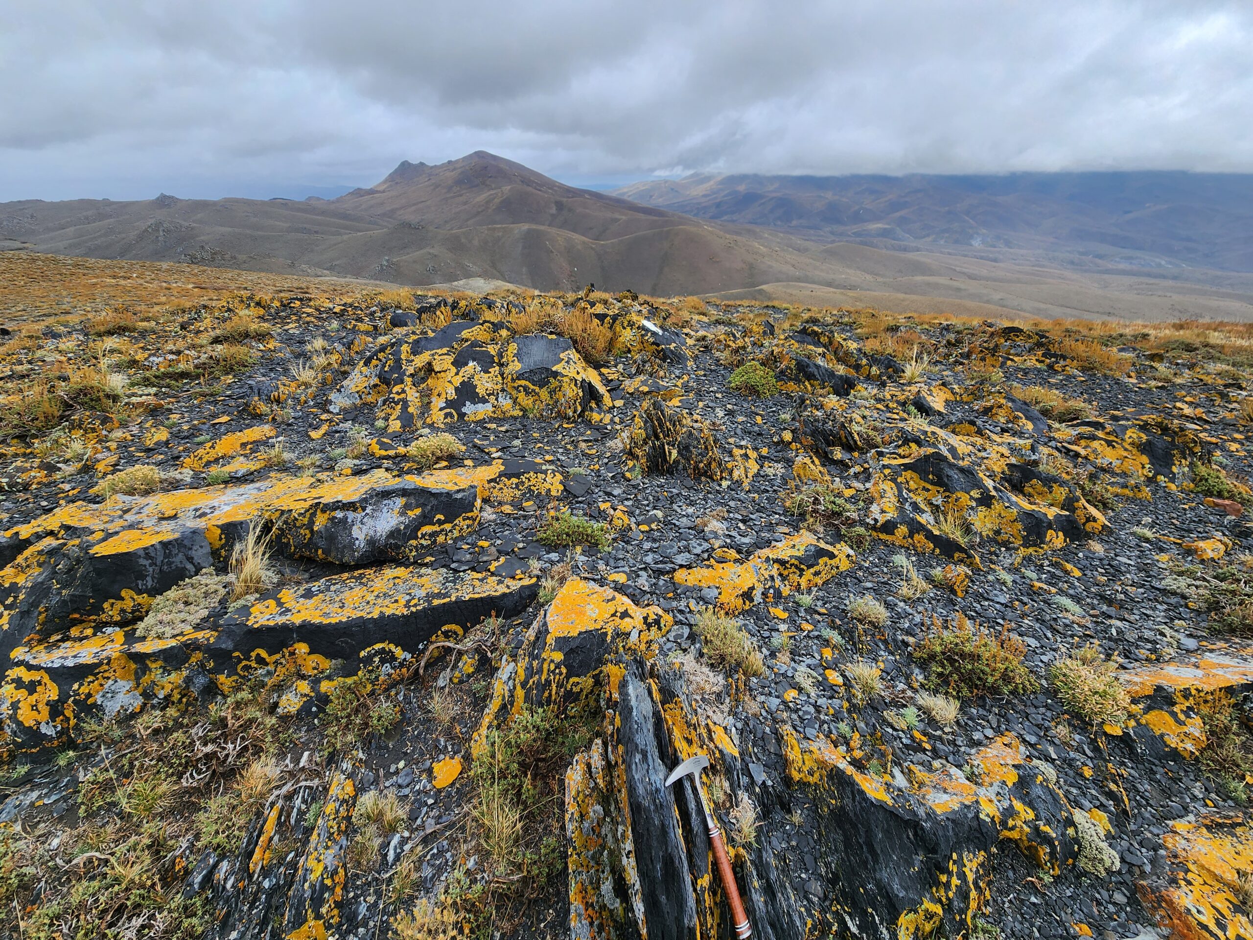
The Sooty Dolostone is distinctive from the other units in both appearance and texture. The dark gray
appearance has a “sooty” or “punky” appearance that is reminiscent of typical carbonaceous carbonates
found elsewhere in Nevada, especially the host rock units found within the Carlin-Trend. This texture
and appearance could bode well for precious metals exploration adjacent to the War Eagle Copper
Project but not necessarily.
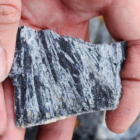
On closer inspection some of the punky texture is due to metamorphism of the dolostone unit. The
metamorphic mineral observed was long-bladed tremolite, which is indicative of relatively low-grade
metamorphism (Figure 14). This level of metamorphism is consistent with the style of hydrothermal
alteration that the entire Paleozoic sediments would have undergone during the emplacement of the
granodiorite stock within the overall Contact District. In addition, the widespread high-angle orientation
of the Paleozoic units indicates a complex structural history and further understanding these
relationships is key for future exploration.
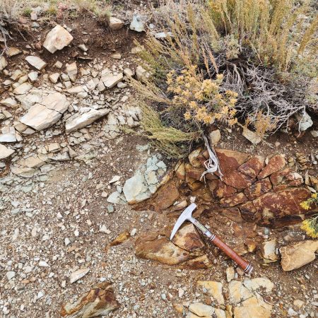
Rusty Quartzite
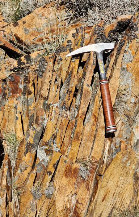
The Rusty Quartzite unit is the third identifiable Paleozoic sedimentary unit found on the War Eagle
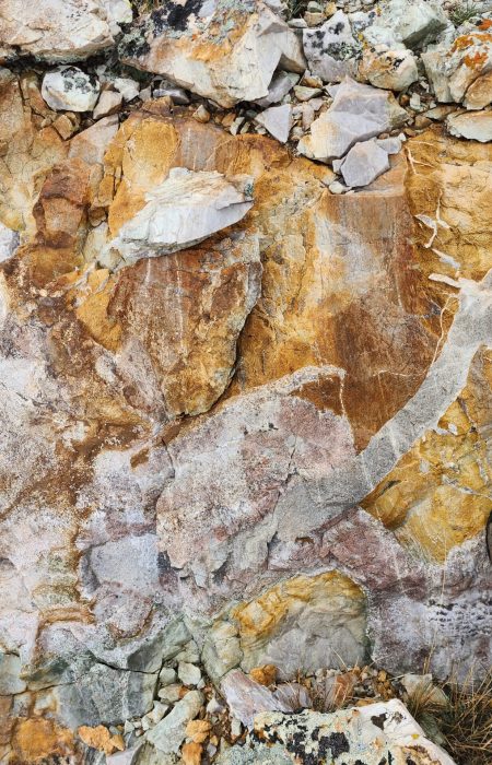
property, so-named do to its “rusty color” and coarse-grained primary sandstone turned to a quartzite
during burial and subsequent metamorphic processes. The high level of silica in this unit would identify
it as a quartzite from the sound of walking across a scree slope of it. It sounds like someone walking
across a pile of porcelain plates, for lack of a better description.
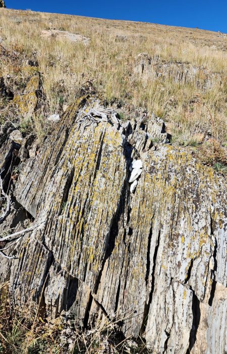
Again, this unit is found in outcrop at a relatively steep angle and like most of the Paleozoic units dips to
the South. In places where it is vertical or dips to the north it is either overturned or part of some tight
isoclinal folding within that area due to local structural geology.
The unit was instrumental in piecing together a rather problematic structural conundrum near the
Hank’s Peak area where the author has interpreted several thrust faults with duplexed stacking of the
Paleozoic units up against the granodiorite stock to the North. If this interpretation is correct then this
area of the property could have numerous favorable structural controls to host mineralization.
Felsic Dikes
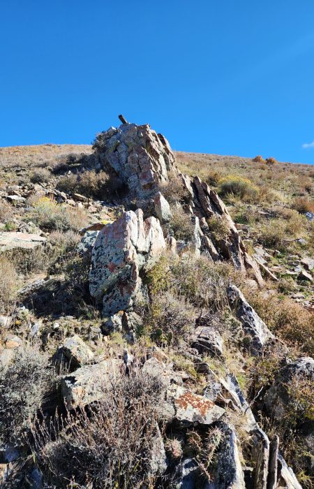
The most ridge-forming feature found across the entire mapping area were felsic dikes. These tabular,
linear features both cross-cut and interfingered with the Paleozoic sediments and granodiorite stock.
They were found from one end of the property (near the Eastern edge of the claims) all the way to the
southern knob of Hank’s Peak (the Western edge).
The potential importance of these and other intrusive-related features, such as hydrothermal alteration
found adjacent to copper mineralization, cannot be over-stated.
The presence of these features by itself
is a great sign of potential episodic mineralizing pulses throughout the entire Contact District. Further
study, in particular, to capture the full extent of these features both within the War Eagle claim block
but also on a more regional scale could help tie together the copper mineralization story.
In a very general sense these features are emplaced when the structural environment accommodates
their emplacement, therefore they interplay with the structural history and can be indicators of
additional, favorable controls to mineralization at depth. Often times this style of intrusive dikes follow
along structural corridors and can pinch/swell along these contacts. Therefore, having a complete
understanding of available structural controls can help identify these corridors of potential
mineralization.
Mineralization
The general style of mineralization found in the Contact District is copper skarn to carbonate
replacement style; the War Eagle property exhibits both kinds. The basic copper skarn mineralization
comprises an intermediate to felsic intrusive stock next to an older reactive carbonate package. At the
War Eagle property, the granodiorite stock on the North side of the claims buts up against the Paleozoic
strata from the South in direct contact with the so-named Banded Limestone unit.
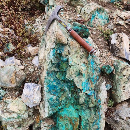
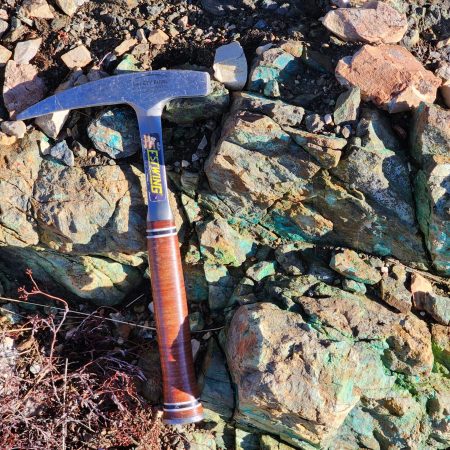
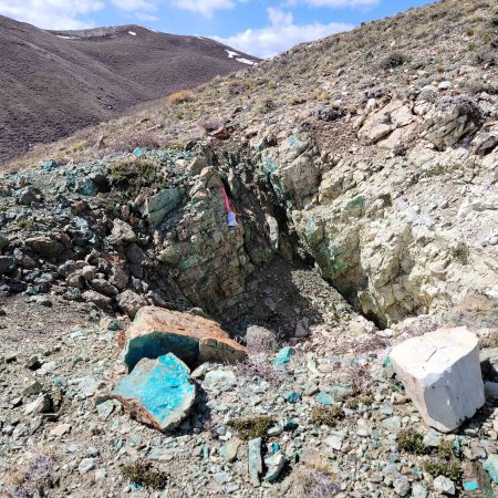
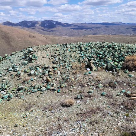
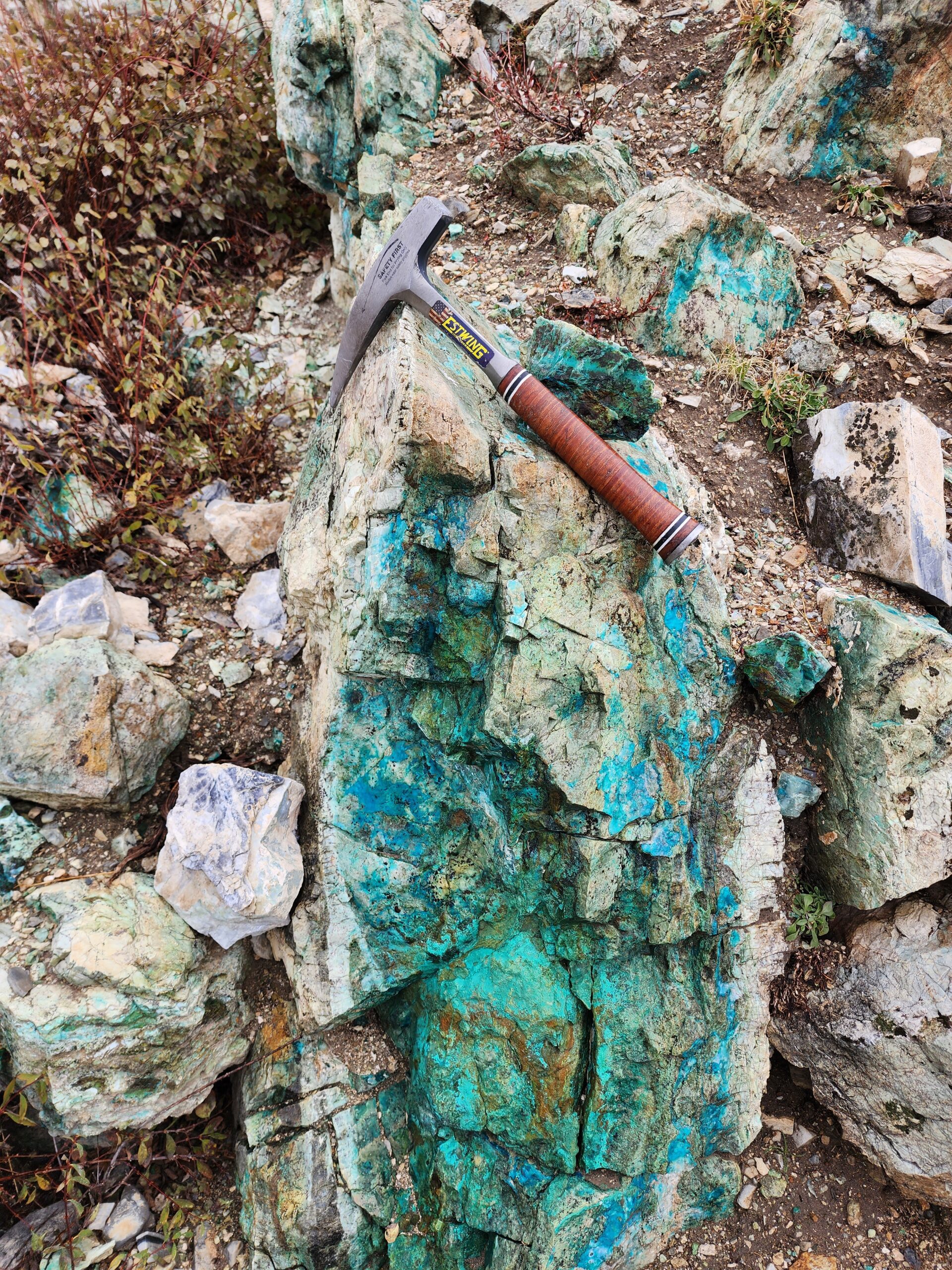
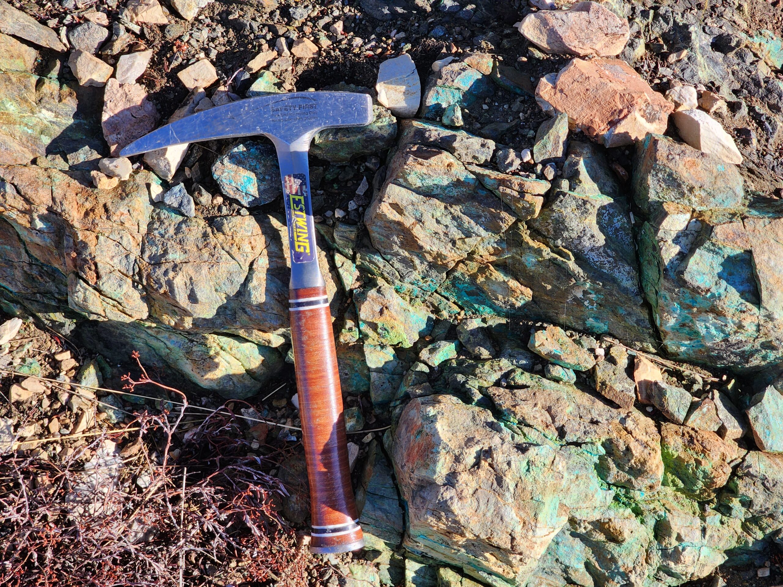
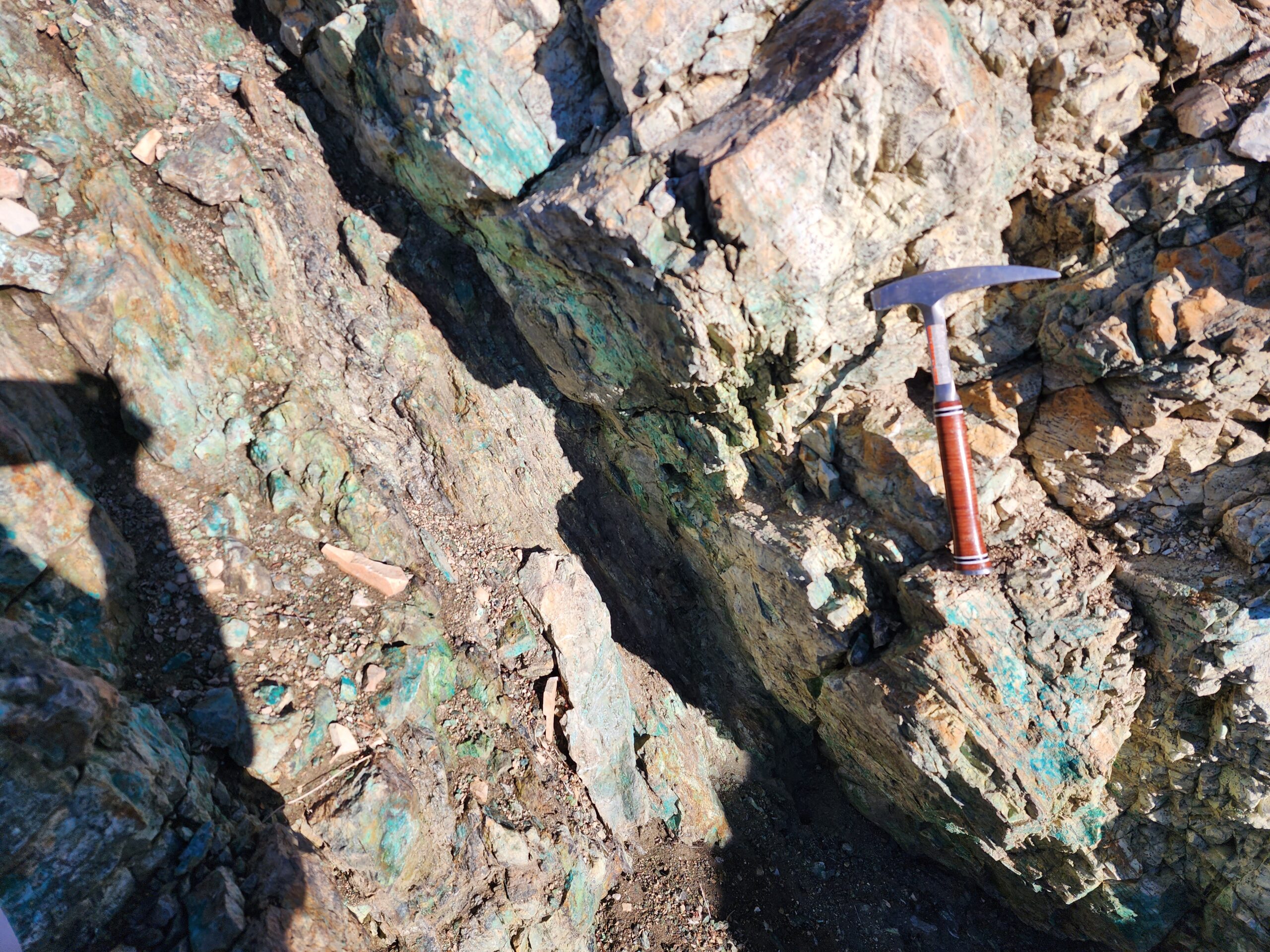
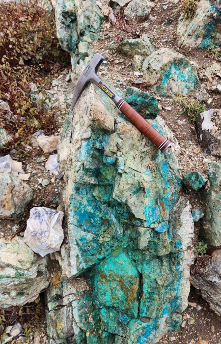
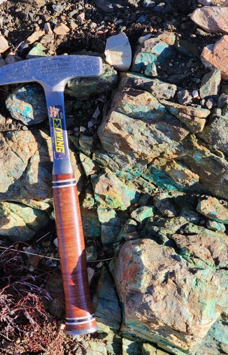
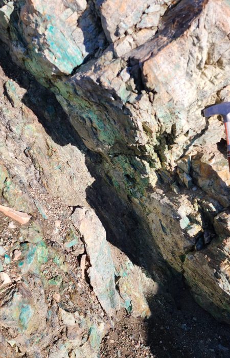
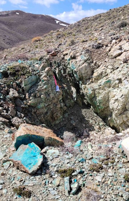
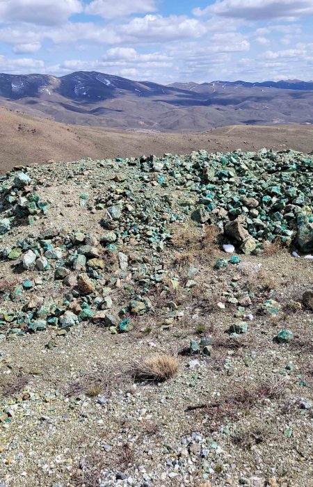
Within the historic diggings on site, such as the Arizona/Turo or Rosie O’Connell/War Eagle mine areas,
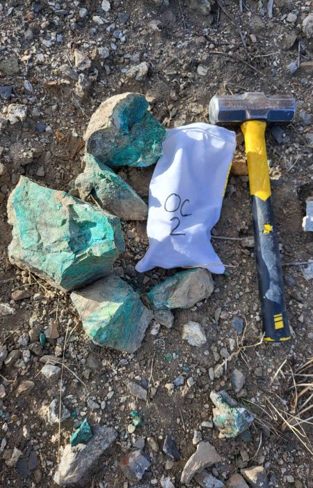
there is pervasive copper mineral showings in the form of bright blue chrysocolla as well as associated
sulfides and alteration. When you find the copper mineralization in-situ within the host rock it occurs
along fractures, joints, breccia, and bedding planes of the Banded Limestone.
Babel Mine
At the Babel Mine, found on the West side of the claim block, there is an excellent example of the skarnstyle contact between the Paleozoic units and the younger granodiorite. At the exact contact itself none 10 | P a g e of the supergene minerals such as chrysocolla are present, rather the contact is host to abundant clay minerals within an argillic alteration halo. This causes both the Banded Limestone unit and granodiorite to be quite friable at this location, in consequence the actual entrance to the mine has collapsed.
Arizona Mine
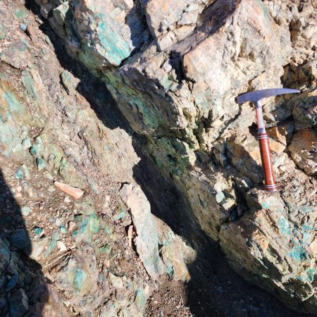
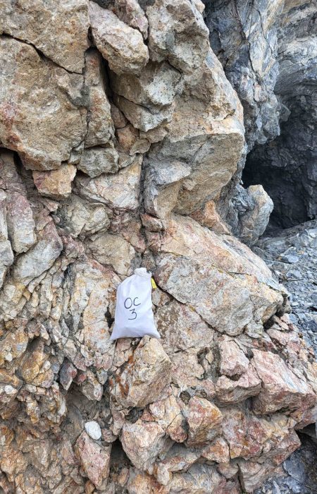
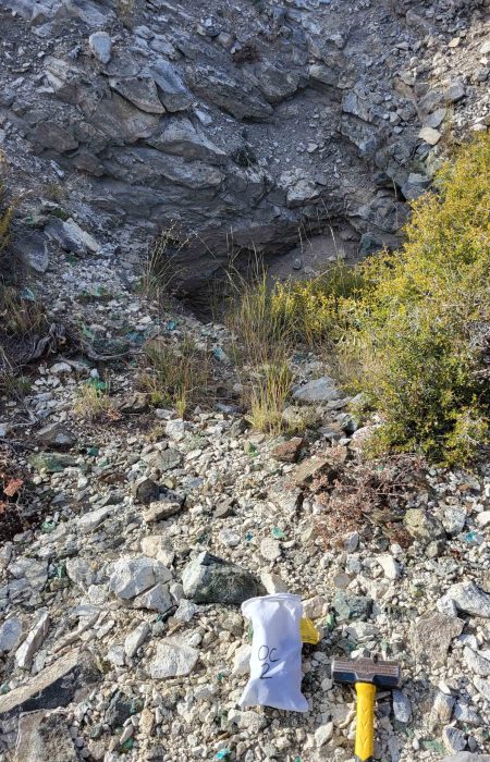
At the Arizona Mine area there is a vertical shaft, which has been barred from entry by Nevada Abandoned Mine Lands (AML), but one can see the steeply inclined beds of the Banded Limestone unit at the copper mineralization is readily apparent both within the historic digging but also along strike to the East and West. Samples in this area (Sample ID SAZ1) have copper assays of 14.75%.
Turo Mine
In the vicinity of the Turo Mine area, just South and West of the Arizona mine, one can see pervasive
copper mineralization. In this area there is an additional feature to the mineralization with the presence
of brecciated carbonates that have been silicified as well as mineralized with bright blue chrysocolla.
Near the Turo mine there are several North-South trending trenches that most likely date to the 1950’s
when several companies were operating in the area such as Phelps Dodge, Exxon Minerals, and
Homestake Mining company. These trenches were more than likely sampled from end to end; this data
would be quite useful. In lieu of finding this historic data it could somewhat easily be re-created by
another sampling program. Current database of samples shows high grade copper in this area as well.
It should be noted that the Turo mine area is copper mineralization that occurs the furthest away from
the Paleozoic – Intrusive contact from currently known and mapped copper mineralization within the
War Eagle claim block. Perhaps the brecciated zone, that occurs along a junction of several mapped
faults has more to tell in regards to additional exploration in that particular area.
War Eagle/Rosie O’Connell Mine
The Rosie O’Connell mine area, which is how it is labeled on USGS topographic maps, is also known as
the War Eagle mine and is the source-name for this project. This mine area is a trend-setter all its own
with the majority of the strike & dip measurements taken along mineralization oriented the opposite
way from its peers. As can be seen in Figure 12, the Banded Limestone and continual host of the bright
blue copper mineralization is dipping to the North (instead of the South as is found elsewhere
throughout the property).
There are two possible explanations for this orientation:
- A) The Banded Limestone beds have been over-turned.
- B) This area has experience isoclinal folding (extremely tight, vertically exaggerated folds).
Option A is more likely than B but more work would be needed to put this debate to bed. Ultimately either option is good in the context of mineralization controls.
Alteration
There has been some discussion pertaining to alteration proceeding this section but it warrants some additional explanation. The various types of alteration and how they relate to the styles of mineralization is an important function of any future exploration efforts. The styles of alteration found at War Eagle are argillic, propylitic, silicic, and potassic alteration.
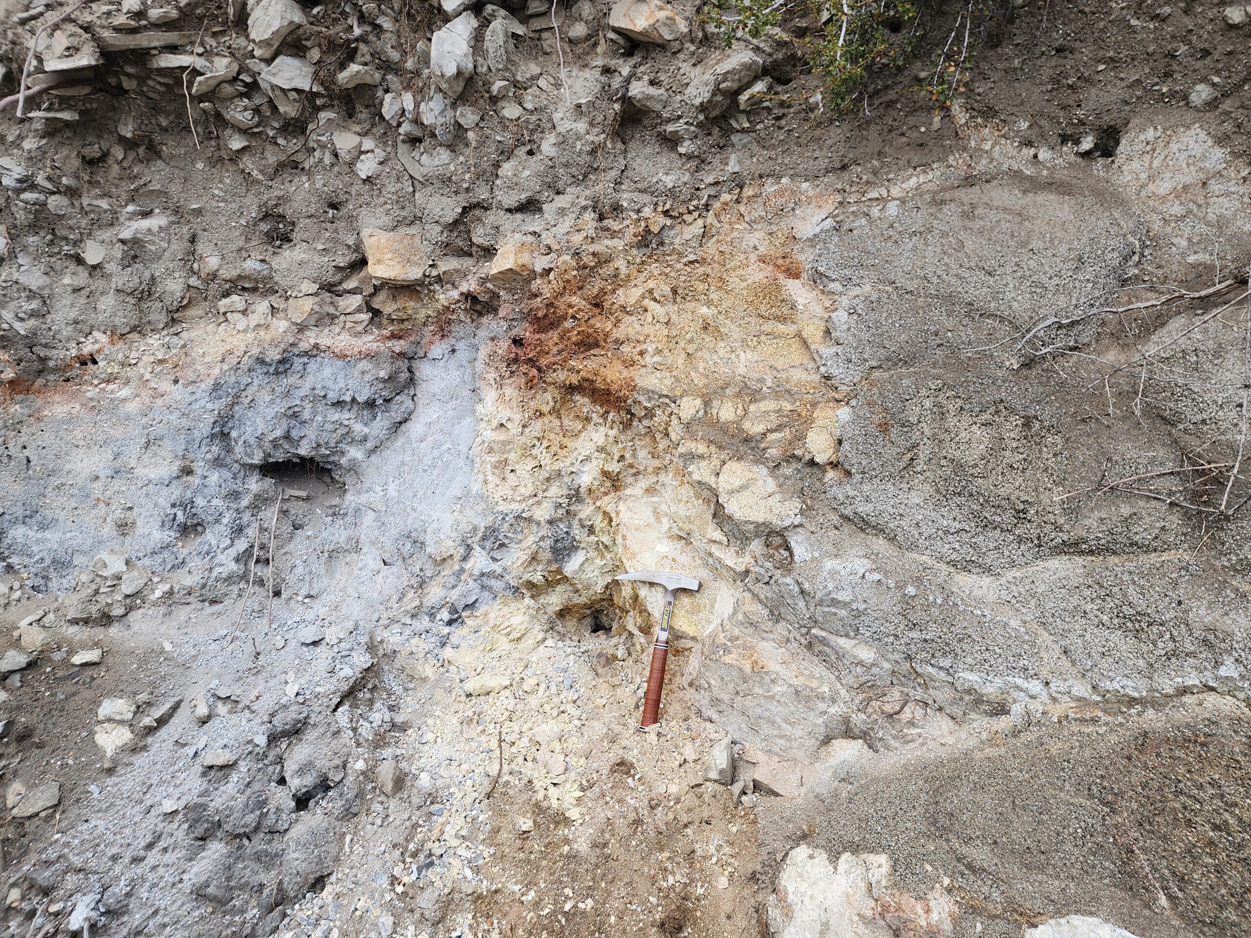
Argillic alteration tends to occur along the Paleozoic – Intrusive contact, but is found elsewhere in
hydrothermally active zones of the reactive carbonates (Figure 13). Propylitic alteration is present
within the tremolite-bearing Sooty Dolostone (Figure 14). Silicic alteration is pervasive within the Rusty
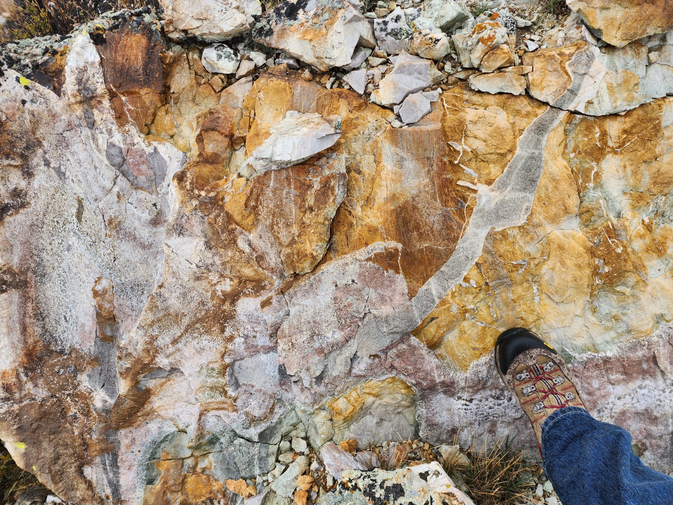
Quartzite but also along contacts with the cross-cutting Felsic Dikes. And potassic alteration was
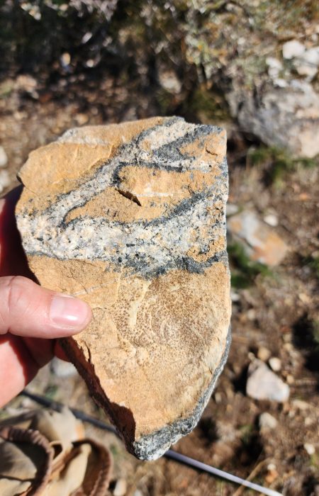
observed in one location where a cross-cutting dike met the Paleozoic – Intrusive contact as depicted in
Figure 4.
The forms of alteration that would most intimately be associated with mineralization are the silicic and
argillic alteration types, however, they all have a part of the story to tell in context with the overall
geology.
Recommendations
The following are some recommendations for further work should Venture Mines, Inc. wish to continue work on the War Eagle Copper Project. There is nothing from the author’s perspective that would warrant any caution or lack of potential mineral endowment. In other words, this project is screaming for more work to be done in order to unlock its true potential.
Geophysical Surveys
Figure 15 below demarcates half a dozen recommended IP lines each cutting North – South across
favorable geology spaced evenly across the project from Hank’s Peak on the West to Rosie O’Connell on
the East. Each one of these lines intersects near either known mineralization, mapped structural
features, and traverse the entire geologic section from Rusty Quartzite to Sooty Dolostone to Banded
Limestone to Granodiorite while also cross-cutting several of the Felsic Dikes.
The lines would confirm the presence of conductors at depth from areas of known mineralization and
could help define targets at depth where surface mapping could only suggest a favorable control in the
area. This work could also help understand the complex structural framework of the mineralizing
system and either confirm or deny some of the author’s complex structural interpretations.
Additional Mapping
As always, more mapping means more detail. Due to time constraints Arkenstone Exploration only spent three days of on-site mapping at the War Eagle property. This surface mapping effort could be expanded, refined, and/or focused on current areas of interest as well as new ones.
Additionally, more focused mapping within the intrusive stock could help with the overall understanding
of the structural environment that the Paleozoic sediments underwent during plutonic emplacement,
but this also might not achieve the state result as crystalline rock can be elusively difficult to map.
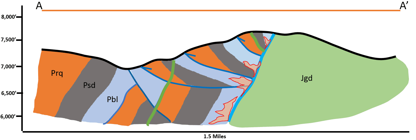
Included here at the end of this report is a conceptual cross-section (as denoted on Figure 15, A – A’
section line). This particular section attempts to interpret the stacked thrust sheets that comprise the
southern slope of Hanks Peak on the West side of the property (Figure 16).
Soil Sampling
Last but certainly not least is soil sampling. This work done in conjunction with geophysics can unlock
otherwise elusive mineral trends that the naked eye cannot detect as well as copper concentrations that
are otherwise hidden undercover (either soil or vegetation).
A simpler version of sampling would be to collect rock chip samples during subsequent geologic
mapping trips and or re-sampling of the four N-S elongate trenches near the center of the property.
Contact
Jeffrey Janda
© Copyright Venture Mines, Inc.
War Eagle Copper
Project

Watch this
project on
YouTube
Introduction
The War Eagle Copper Project is located Northern Elko
County, Nevada; about 50 miles North of Wells, NV along U.S.
Highway 93 (Figure 1).
The project is part of the Southern
end of the Contact District, which is known for historic and
more recent copper, gold, silver, and other base metal
exploration.
The War Eagle property is a set of lode claims that span 2
square miles within an Area of Interest (AOI) that is
comprised of 15 square miles in Township 44 North, Range
64 East, of the Southern Granite Range of Elko Co., NV.
Recent work by Arkenstone Exploration includes field work
that comprised geologic mapping and structural
interpretation as well as the desktop compilation of the
mapping work into a cohesive geologic map of the War Eagle
property.
Geologic Mapping
The geologic mapping completed on site was conducted over three field days from Oct. 3rd thru 5th
,
2023. Arkenstone Exploration utilized a GPS-enabled tablet to record geologic and structural data
across much of the current claim block.
The 1
st day of mapping centered around the Arizona/Turo mine
areas as marked on original USGS topo maps.
Subsequent days focused on areas along strike of the Paleozoic – Intrusive contact in both directions
(East & West). This approach allowed for a very efficient mapping program that achieved full-coverage
of relevant geology within the claim block area.
Besides the tablet for recording point data and notes at each stop, a Brunton Geo-Transit was used to
collect strike & drip measurements of Paleozoic strata and other linear features such as Felsic Dikes and
the Paleozoic – Intrusive contact.
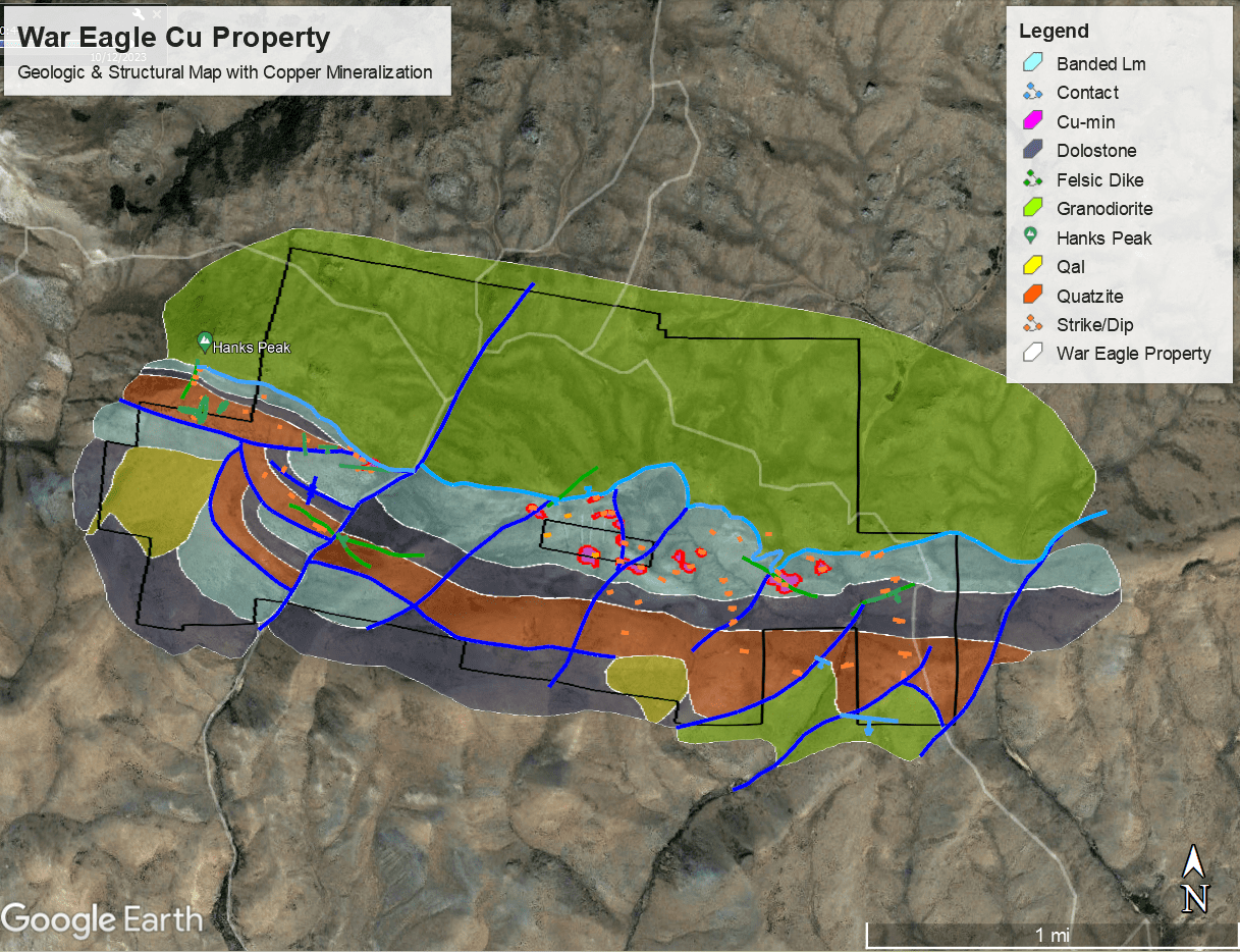
In the end the data was compiled within Google Earth and the geologic and structural interpretations
were made at the desktop level base on notes made in the field and observations highlighted by
available aerial imagery (Figure 2).
Geology
The geologic units of the War Eagle property are part of the Southern Contact District and are
presumably similar to the documented Paleozoic section found in the North and West Contact District.
At this time Arkenstone is unable to make a 1:1 comparison of those units to the units found between
Hank’s Peak along strike towards Blanchard Mountain. Much of the geologic mapping focused on the
Paleozoic sedimentary units due to their reactivity and structural importance to copper mineralization.
The intrusive granodiorite pluton could potentially host small deposits along its fringes, but this is less
likely than larger skarn or replacement style mineralization within the Paleozoic carbonate host units.
Further work might focus more on potential pegmatites or felsic dikes that cross-cut both the
granodiorite as well as the Paleozoics, but that was not the focus of this initial reconnaissance mapping.
However, the mapping was successful in identifying three repeatable units in sequence. These
sedimentary units are as follows, from the bottom of the local stratigraphic section to the top:
- A) Banded Limestone
- B) Sooty Dolostone
- C) Rusty Quartzite
This sequence was observed in sequence
across the entire project area and the author is confident that these strata (Figure 3) will be observed elsewhere along strike. It should be noted as well that copper mineralization has only been observed
within the Banded Limestone unit that is in direct contact with the granodiorite or adjacent to felsic
dikes.
The structural setting on site is quite complex with nearly all sedimentary units near the Paleozoic –
Intrusive contact oriented at high angles or overturned. One area (highlighted on Figure 2) is an
interpreted Thrust Fault area that sits adjacent to a North-East trending fault. The south peak of Hanks
Peak was observed as a thrust sheet of Rusty Quartzite with at least two further duplexed thrust folds
paralleling this stacked structural system.
Granodiorite
The Contact district’s granodiorite stock is comprised of a medium to coarse grained rock that contains
quartz and is distinguished from granite by having more plagioclase than orthoclase feldspar; other
minerals include hornblende, biotite, and augite. Along the Paleozoic – Intrusive contact North and
West of the Arizona Mine area there was observed a pegmatitic texture to the granodiorite with an
interpreted felsic dike cross-cutting both the intrusive and Paleozoic units at an ENE trend. This feature
was mapped and can be found on the accompanying geologic map (Figure 2).
Besides the granodiorite serving as an obvious heat source for mineralization, it would also seem that
this relationship between cross-cutting features such as the pegmatitic felsic dike and coeval structures
that carry into the Paleozoic sediments could be a pathway for enhanced mineralization and evidence of
multiple episodes or pulses of ore-bearing fluids into the carbonate host rocks.
Banded Limestone
The Banded Limestone unit is quite distinguishable from all other units found in the War Eagle project
area. All of the readily observable copper mineralization, especially that mineralization found around
the historic diggings (Babel, Arizona/Turo, & Rosie O’Connell/War Eagle areas), are all found within this
unit that lies in direct contact with the granodiorite stock.
The Banded Limestone unit is a thinly laminated, fine-grained limestone. The unit has some observable
cherty bands locally, while those same cherty bands are absent within other locations or horizons and
therefore could simply be an alteration feature. The unit as a whole has a bluish-white to light gray
color that is easily identified from a distance as well as from aerial imagery.
Along strike this same unit is presumably the dominant unit that comprises “White Peaks” on China
Mountain to the West of the War Eagle project. This area was not mapped by the author, however,
during the traverse up to Hank’s Peak (which is on the North-Western most reaches of the current claim
block) the distinct Banded Limestone unit is easily traced across the mountain range from one peak to
the next.
Sooty Dolostone
The Sooty Dolostone is distinctive from the other units in both appearance and texture. The dark gray appearance has a “sooty” or “punky” appearance that is reminiscent of typical carbonaceous carbonates found elsewhere in Nevada, especially the host rock units found within the Carlin-Trend. This texture and appearance could bode well for precious metals exploration adjacent to the War Eagle Copper Project but not necessarily.
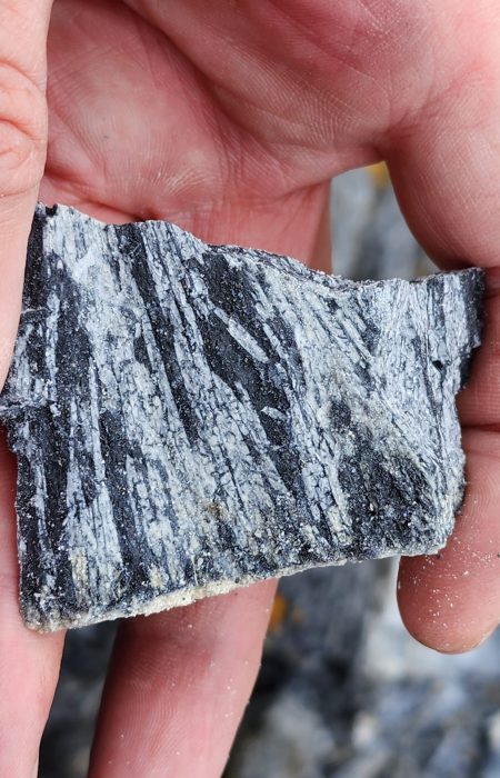
On closer inspection some of the punky texture is due to metamorphism of the dolostone unit. The metamorphic mineral observed was long-bladed tremolite, which is indicative of relatively low-grade metamorphism (Figure 14).
This level of metamorphism is consistent with the style of hydrothermal alteration that the entire Paleozoic sediments would have undergone during the emplacement of the granodiorite stock within the overall Contact District.
In addition, the widespread high-angle orientation of the Paleozoic units indicates a complex structural history and further understanding these relationships is key for future exploration.
Rusty Quartzite
The Rusty Quartzite unit is the third identifiable Paleozoic sedimentary unit found on the War Eagle property, so-named do to its “rusty color” and coarse-grained primary sandstone turned to a quartzite during burial and subsequent metamorphic processes. The high level of silica in this unit would identify it as a quartzite from the sound of walking across a scree slope of it. It sounds like someone walking across a pile of porcelain plates, for lack of a better description.
Again, this unit is found in outcrop at a relatively steep angle and like most of the Paleozoic units dips to the South. In places where it is vertical or dips to the north it is either overturned or part of some tight isoclinal folding within that area due to local structural geology.
The unit was instrumental in piecing together a rather problematic structural conundrum near the Hank’s Peak area where the author has interpreted several thrust faults with duplexed stacking of the Paleozoic units up against the granodiorite stock to the North. If this interpretation is correct then this area of the property could have numerous favorable structural controls to host mineralization.
Felsic Dikes
The most ridge-forming feature found across the entire mapping area were felsic dikes. These tabular, linear features both cross-cut and interfingered with the Paleozoic sediments and granodiorite stock. They were found from one end of the property (near the Eastern edge of the claims) all the way to the southern knob of Hank’s Peak (the Western edge).
The potential importance of these and other intrusive-related features, such as hydrothermal alteration found adjacent to copper mineralization, cannot be over-stated.
The presence of these features by itself is a great sign of potential episodic mineralizing pulses throughout the entire Contact District. Further study, in particular, to capture the full extent of these features both within the War Eagle claim block but also on a more regional scale could help tie together the copper mineralization story.
In a very general sense these features are emplaced when the structural environment accommodates their emplacement, therefore they interplay with the structural history and can be indicators of additional, favorable controls to mineralization at depth. Often times this style of intrusive dikes follow along structural corridors and can pinch/swell along these contacts. Therefore, having a complete understanding of available structural controls can help identify these corridors of potential mineralization.
Mineralization
The general style of mineralization found in the Contact District is copper skarn to carbonate
replacement style; the War Eagle property exhibits both kinds. The basic copper skarn mineralization
comprises an intermediate to felsic intrusive stock next to an older reactive carbonate package. At the
War Eagle property, the granodiorite stock on the North side of the claims buts up against the Paleozoic
strata from the South in direct contact with the so-named Banded Limestone unit.
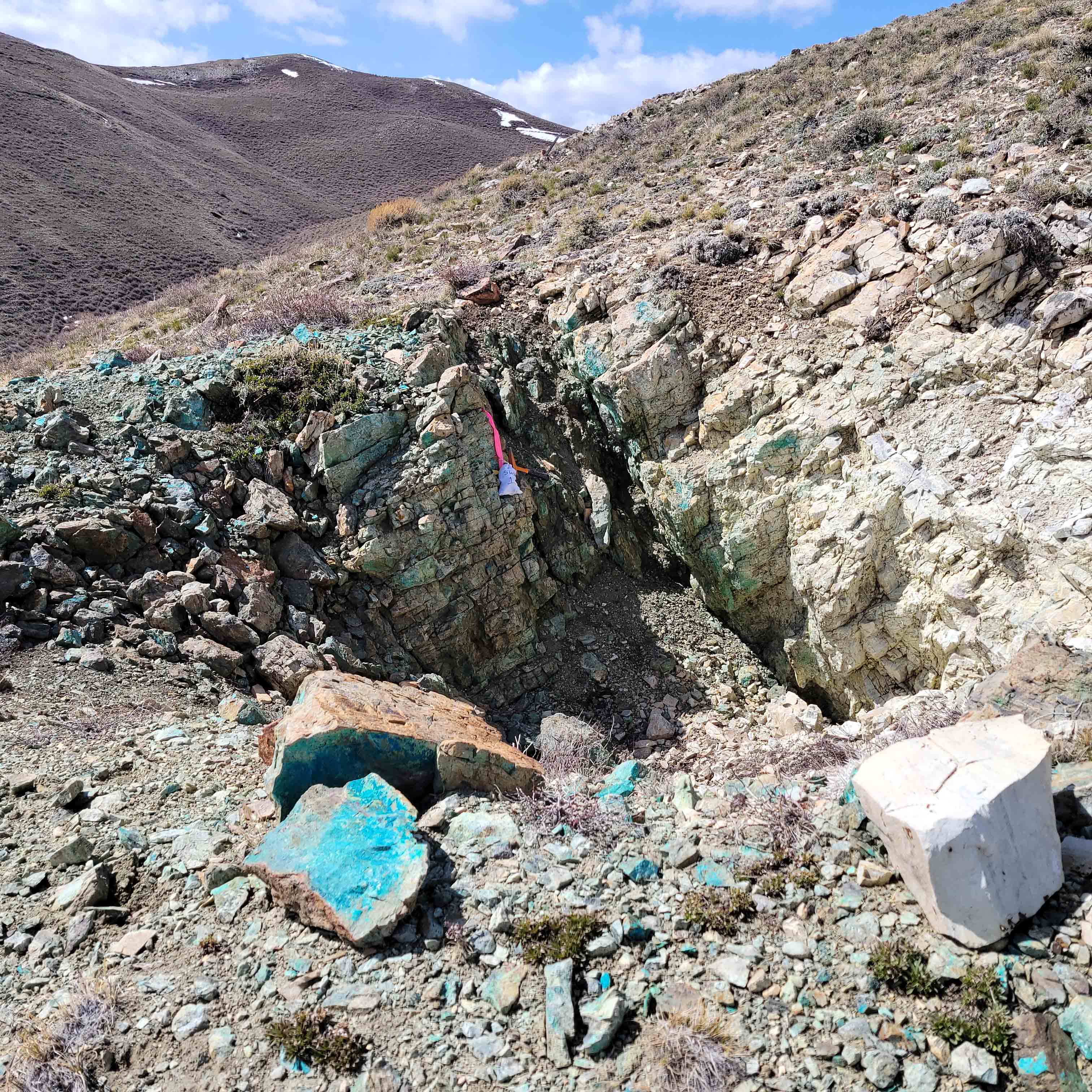
Within the historic diggings on site, such as the Arizona/Turo or Rosie O’Connell/War Eagle mine areas,
there is pervasive copper mineral showings in the form of bright blue chrysocolla as well as associated
sulfides and alteration. When you find the copper mineralization in-situ within the host rock it occurs
along fractures, joints, breccia, and bedding planes of the Banded Limestone.
Babel Mine
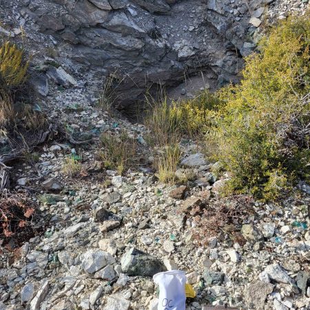
At the Babel Mine, found on the West side of the claim block, there is an excellent example of the skarnstyle contact between the Paleozoic units and the younger granodiorite. At the exact contact itself none 10 | P a g e of the supergene minerals such as chrysocolla are present, rather the contact is host to abundant clay minerals within an argillic alteration halo. This causes both the Banded Limestone unit and granodiorite to be quite friable at this location, in consequence the actual entrance to the mine has collapsed.
Arizona Mine
At the Arizona Mine area there is a vertical shaft, which has been barred from entry by Nevada Abandoned Mine Lands (AML), but one can see the steeply inclined beds of the Banded Limestone unit at the copper mineralization is readily apparent both within the historic digging but also along strike to the East and West. Samples in this area (Sample ID SAZ1) have copper assays of 14.75%.
Turo Mine
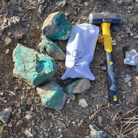
In the vicinity of the Turo Mine area, just South and West of the Arizona mine, one can see pervasive copper mineralization. In this area there is an additional feature to the mineralization with the presence of brecciated carbonates that have been silicified as well as mineralized with bright blue chrysocolla.
Near the Turo mine there are several North-South trending trenches that most likely date to the 1950’s
when several companies were operating in the area such as Phelps Dodge, Exxon Minerals, and
Homestake Mining company. These trenches were more than likely sampled from end to end; this data
would be quite useful. In lieu of finding this historic data it could somewhat easily be re-created by
another sampling program. Current database of samples shows high grade copper in this area as well.
It should be noted that the Turo mine area is copper mineralization that occurs the furthest away from
the Paleozoic – Intrusive contact from currently known and mapped copper mineralization within the
War Eagle claim block. Perhaps the brecciated zone, that occurs along a junction of several mapped
faults has more to tell in regards to additional exploration in that particular area.
War Eagle/Rosie O’Connell Mine
The Rosie O’Connell mine area, which is how it is labeled on USGS topographic maps, is also known as
the War Eagle mine and is the source-name for this project. This mine area is a trend-setter all its own
with the majority of the strike & dip measurements taken along mineralization oriented the opposite
way from its peers. As can be seen in Figure 12, the Banded Limestone and continual host of the bright
blue copper mineralization is dipping to the North (instead of the South as is found elsewhere
throughout the property).
There are two possible explanations for this orientation:
- A) The Banded Limestone beds have been over-turned.
- B) This area has experience isoclinal folding (extremely tight, vertically exaggerated folds).
Option A is more likely than B but more work would be needed to put this debate to bed. Ultimately either option is good in the context of mineralization controls.
Alteration
There has been some discussion pertaining to alteration proceeding this section but it warrants some additional explanation. The various types of alteration and how they relate to the styles of mineralization is an important function of any future exploration efforts. The styles of alteration found at War Eagle are argillic, propylitic, silicic, and potassic alteration.
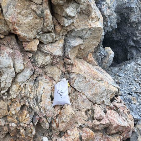
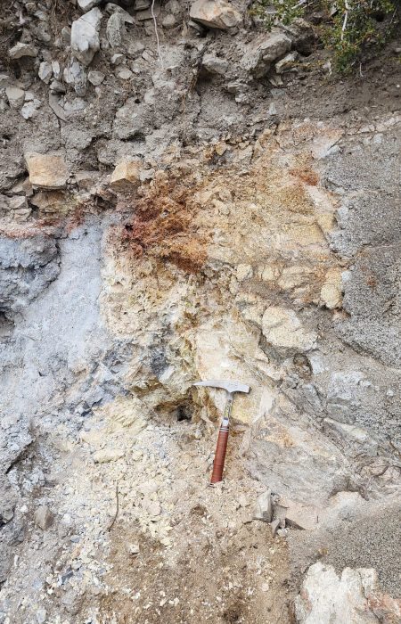
Argillic alteration tends to occur along the Paleozoic – Intrusive contact, but is found elsewhere in hydrothermally active zones of the reactive carbonates (Figure 13). Propylitic alteration is present within the tremolite-bearing Sooty Dolostone (Figure 14). Silicic alteration is pervasive within the Rusty Quartzite but also along contacts with the cross-cutting Felsic Dikes. And potassic alteration was observed in one location where a cross-cutting dike met the Paleozoic – Intrusive contact as depicted in Figure 4.
The forms of alteration that would most intimately be associated with mineralization are the silicic and argillic alteration types, however, they all have a part of the story to tell in context with the overall geology.
Recommendations
The following are some recommendations for further work should Venture Mines, Inc. wish to continue work on the War Eagle Copper Project. There is nothing from the author’s perspective that would warrant any caution or lack of potential mineral endowment. In other words, this project is screaming for more work to be done in order to unlock its true potential.
Geophysical Surveys
Figure 15 below demarcates half a dozen recommended IP lines each cutting North – South across favorable geology spaced evenly across the project from Hank’s Peak on the West to Rosie O’Connell on the East. Each one of these lines intersects near either known mineralization, mapped structural features, and traverse the entire geologic section from Rusty Quartzite to Sooty Dolostone to Banded Limestone to Granodiorite while also cross-cutting several of the Felsic Dikes.
The lines would confirm the presence of conductors at depth from areas of known mineralization and could help define targets at depth where surface mapping could only suggest a favorable control in the area. This work could also help understand the complex structural framework of the mineralizing system and either confirm or deny some of the author’s complex structural interpretations.
Additional Mapping
As always, more mapping means more detail. Due to time constraints Arkenstone Exploration only spent three days of on-site mapping at the War Eagle property. This surface mapping effort could be expanded, refined, and/or focused on current areas of interest as well as new ones.
Additionally, more focused mapping within the intrusive stock could help with the overall understanding of the structural environment that the Paleozoic sediments underwent during plutonic emplacement, but this also might not achieve the state result as crystalline rock can be elusively difficult to map.
Included here at the end of this report is a conceptual cross-section (as denoted on Figure 15, A – A’ section line). This particular section attempts to interpret the stacked thrust sheets that comprise the southern slope of Hanks Peak on the West side of the property (Figure 16).
Soil Sampling
Last but certainly not least is soil sampling. This work done in conjunction with geophysics can unlock otherwise elusive mineral trends that the naked eye cannot detect as well as copper concentrations that are otherwise hidden undercover (either soil or vegetation).
A simpler version of sampling would be to collect rock chip samples during subsequent geologic mapping trips and or re-sampling of the four N-S elongate trenches near the center of the property.
Contact
Jeffrey Janda
© Copyright Venture Mines, Inc.
